Trail Creek Road, east of Bozeman, offers drive thru history
Just east of Bozeman, Trail Creek Road provides a scenic drive through history.
Trail Creek Road follows Meadow and Trail creeks along the edge of the Custer Gallatin National Forest. Surrounding the route are rural homes built where coal mining thrived from the 1870s till around 1910.
![Trail Creek Road](https://bloximages.chicago2.vip.townnews.com/billingsgazette.com/content/tncms/assets/v3/editorial/9/a0/9a0046a0-5c96-11ee-94e3-8b794c98ed53/65131c4759fdb.image.jpg?resize=150%2C90 150w, https://bloximages.chicago2.vip.townnews.com/billingsgazette.com/content/tncms/assets/v3/editorial/9/a0/9a0046a0-5c96-11ee-94e3-8b794c98ed53/65131c4759fdb.image.jpg?resize=200%2C121 200w, https://bloximages.chicago2.vip.townnews.com/billingsgazette.com/content/tncms/assets/v3/editorial/9/a0/9a0046a0-5c96-11ee-94e3-8b794c98ed53/65131c4759fdb.image.jpg?resize=225%2C136 225w, https://bloximages.chicago2.vip.townnews.com/billingsgazette.com/content/tncms/assets/v3/editorial/9/a0/9a0046a0-5c96-11ee-94e3-8b794c98ed53/65131c4759fdb.image.jpg?resize=300%2C181 300w, https://bloximages.chicago2.vip.townnews.com/billingsgazette.com/content/tncms/assets/v3/editorial/9/a0/9a0046a0-5c96-11ee-94e3-8b794c98ed53/65131c4759fdb.image.jpg?resize=400%2C241 400w, https://bloximages.chicago2.vip.townnews.com/billingsgazette.com/content/tncms/assets/v3/editorial/9/a0/9a0046a0-5c96-11ee-94e3-8b794c98ed53/65131c4759fdb.image.jpg?resize=540%2C325 540w, https://bloximages.chicago2.vip.townnews.com/billingsgazette.com/content/tncms/assets/v3/editorial/9/a0/9a0046a0-5c96-11ee-94e3-8b794c98ed53/65131c4759fdb.image.jpg?resize=640%2C386 640w, https://bloximages.chicago2.vip.townnews.com/billingsgazette.com/content/tncms/assets/v3/editorial/9/a0/9a0046a0-5c96-11ee-94e3-8b794c98ed53/65131c4759fdb.image.jpg?resize=750%2C452 750w, https://bloximages.chicago2.vip.townnews.com/billingsgazette.com/content/tncms/assets/v3/editorial/9/a0/9a0046a0-5c96-11ee-94e3-8b794c98ed53/65131c4759fdb.image.jpg?resize=990%2C597 990w, https://bloximages.chicago2.vip.townnews.com/billingsgazette.com/content/tncms/assets/v3/editorial/9/a0/9a0046a0-5c96-11ee-94e3-8b794c98ed53/65131c4759fdb.image.jpg?resize=1035%2C624 1035w, https://bloximages.chicago2.vip.townnews.com/billingsgazette.com/content/tncms/assets/v3/editorial/9/a0/9a0046a0-5c96-11ee-94e3-8b794c98ed53/65131c4759fdb.image.jpg?resize=1200%2C723 1200w, https://bloximages.chicago2.vip.townnews.com/billingsgazette.com/content/tncms/assets/v3/editorial/9/a0/9a0046a0-5c96-11ee-94e3-8b794c98ed53/65131c4759fdb.image.jpg?resize=1333%2C803 1333w, https://bloximages.chicago2.vip.townnews.com/billingsgazette.com/content/tncms/assets/v3/editorial/9/a0/9a0046a0-5c96-11ee-94e3-8b794c98ed53/65131c4759fdb.image.jpg?resize=1476%2C890 1476w, https://bloximages.chicago2.vip.townnews.com/billingsgazette.com/content/tncms/assets/v3/editorial/9/a0/9a0046a0-5c96-11ee-94e3-8b794c98ed53/65131c4759fdb.image.jpg 2008w)
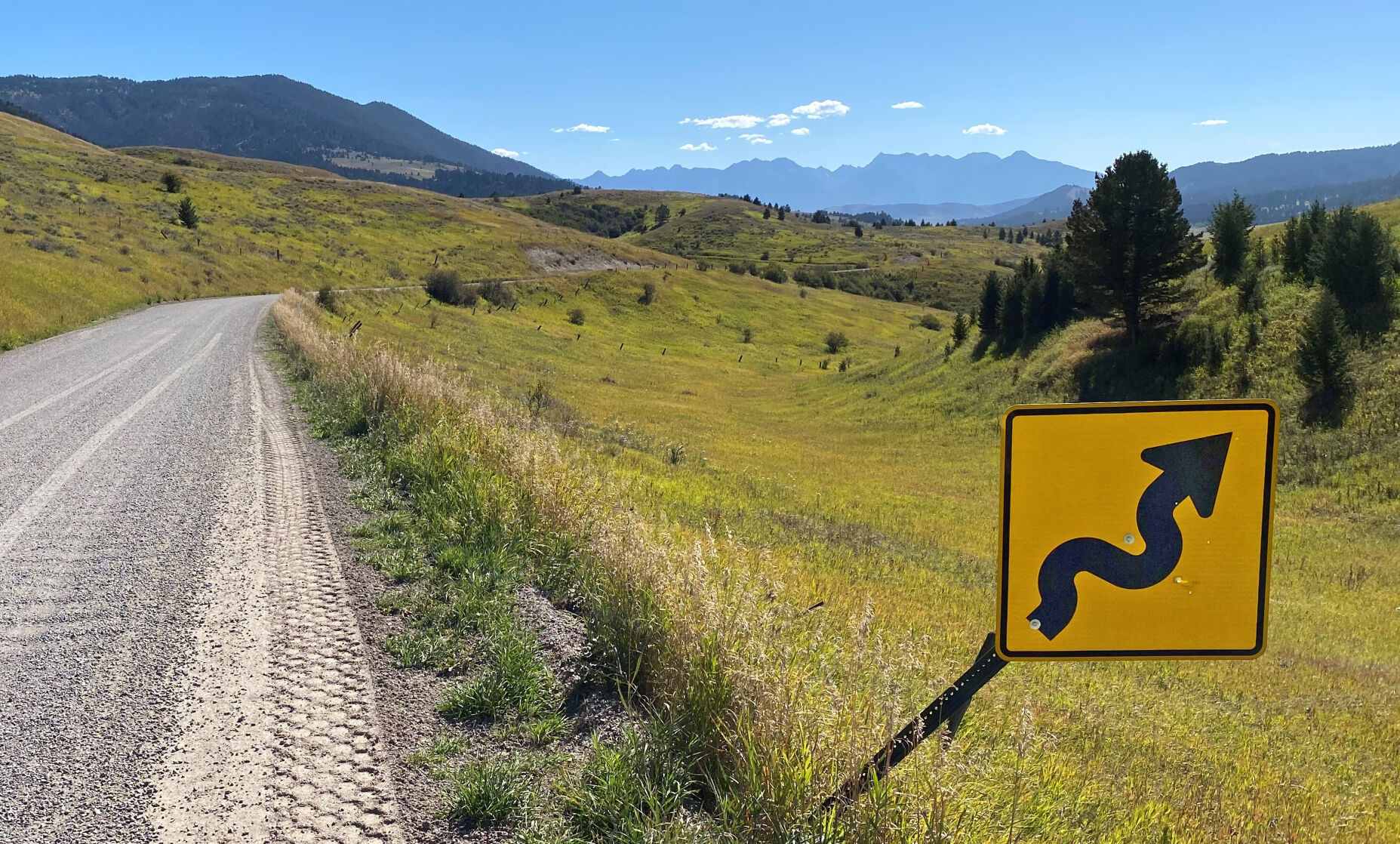
Trail Creek Road connects the Paradise and Bozeman valleys via a rural route.
At Exit 316 is the small community of Chestnut, named after James D. Chestnut who dug the first coal mine, according to a history written by Gallatin County. By the early 1900s, the Anaconda Copper Co.’s predecessor was mining in the region, which also featured coke ovens to convert the coal to coke for smelting.
The Turkey Trail Railroad ran from Chestnut to the Maxey Mines, just southeast of the low pass between Meadow and Trail creeks. The county road now travels through the cut made for the Turkey Trail Railroad. The railroad lasted from 1899 to 1918.
People are also reading…
“Sawmills were built to furnish material for logging, timbering, trestling, ties, and buildings,” the county reported. “The sawdust produced as a by-product for the area was used for insulation, floor covering, and packing. The last sawmill in the area closed in the mid 1940s.”
Before highways, the drainage was also a common route for horse and stage travel between Bozeman and Yellowstone National Park.
Driving southeast from Bozeman, Trail Creek Road provides an alternate view of the much-loved Absaroka Mountains lining the Paradise Valley. The road splits about 12 miles from the interstate, offering travelers the option of continuing farther south around Antelope Butte, or striking pavement more quickly by paralleling The Hogback, a prominent ridge.
To access the road, take Exit 316 off Interstate 90, just after Bear Canyon if you are traveling east.
There are two options to drive this road from the Paradise Valley side. The first is to turn onto Old Yellowstone Trail off Highway 89, about 7 miles south of Livingston (just before the Pine Creek Road). Or you could continue farther south, about 9 more miles, to Paradise Ranch Road. Both roads connect to Trail Creek Road.
Read More: Trail Creek Road, east of Bozeman, offers drive thru history